Learn how to check the current traffic in the Apple Maps app on your iPhone, iPad, or Mac to avoid congestions, road closures, and construction work, saving time.
Venturing out on the open road only to be slowed down by an accident, construction, or a closed road will cost you time and nerves. With Apple Maps, you can be alerted about these and other types of traffic conditions before they turn what was supposed to be a short drive into an exercise in frustration.
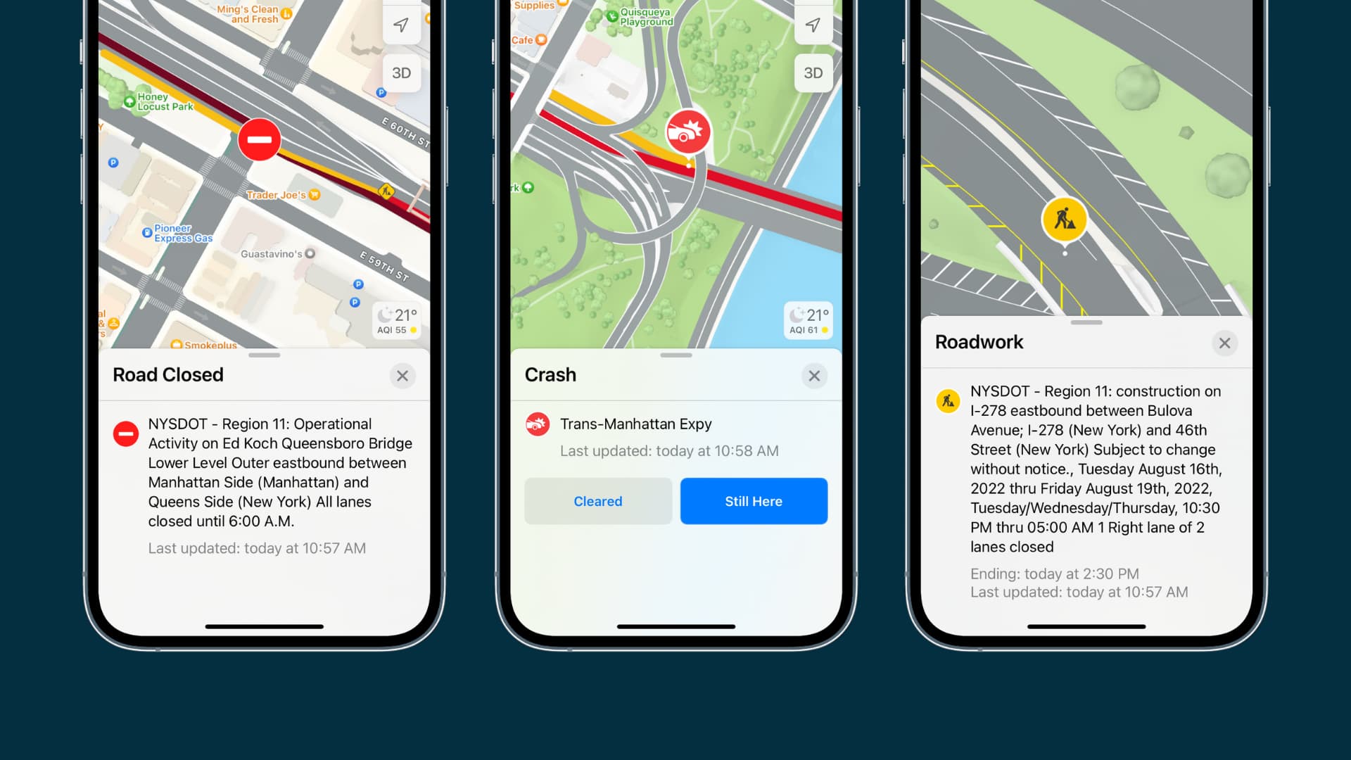
See the traffic conditions in Apple Maps on iPhone and iPad
Follow these instructions to view the current traffic conditions in Apple Maps on your iPhone and iPad, in either Driving or Satellite view.
- Open the built-in Maps app and search for your destination.
- Tap the map button above the arrow-shaped location icon near the bottom-right corner.
- Select Driving or Satellite in the Map Modes panel. If you select the latter, turn on the Traffic switch. Then, tap X to close the panel.

You’ll start seeing local traffic conditions in Driving and Satellite views, with orange indicating slowdowns and red used for heavy/stop-and-go traffic. You may also see tiny yellow and red icons signifying road hazards like lane closure (⚠️), road closure (⛔), accidents, roadwork, etc. You can tap these a sign to learn more about the specific hazard.
Traffic conditions in Apple Maps on a Mac
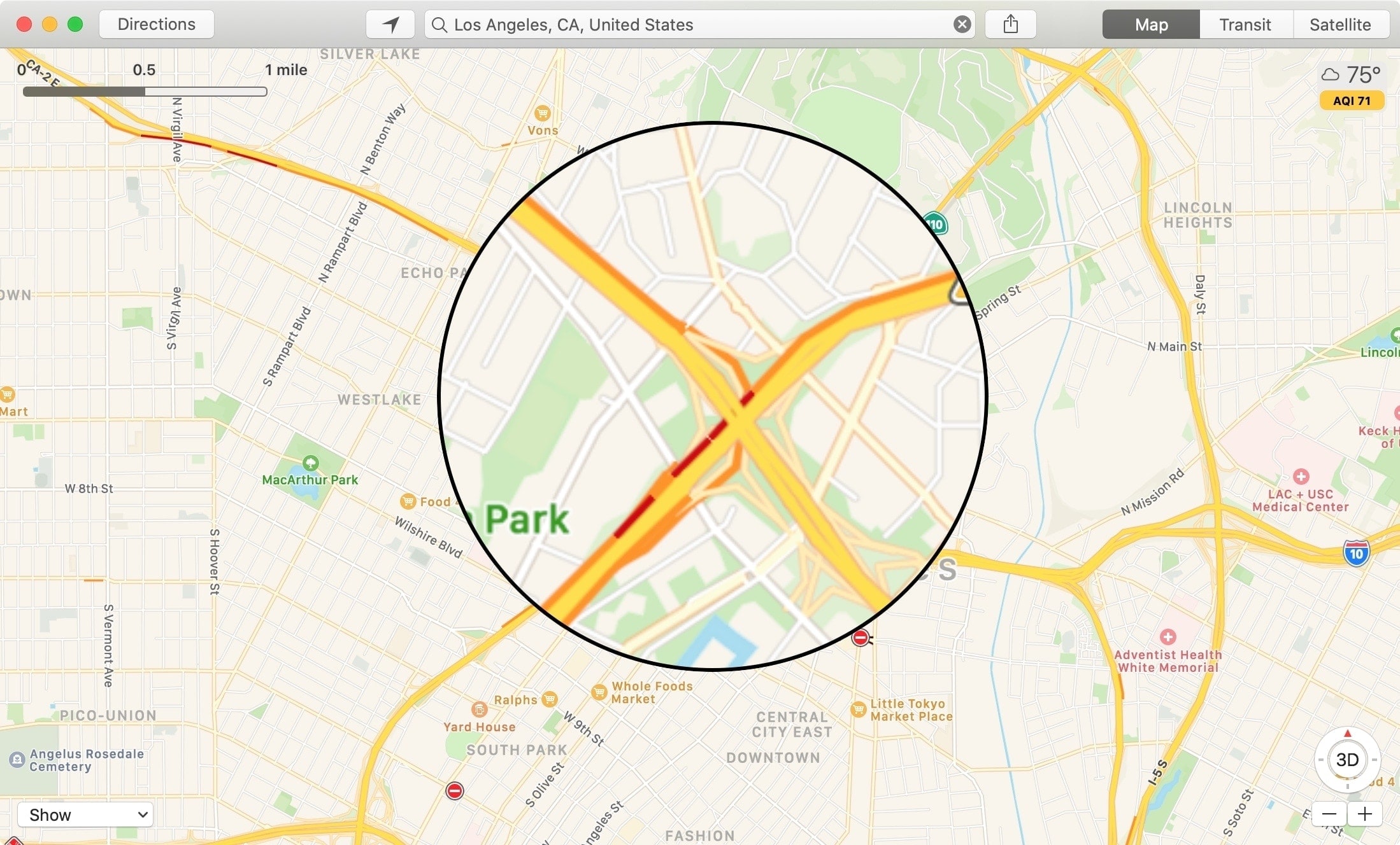
Be sure you’re in Driving or Satellite mode before following the Mac instructions below.
- Open the built-in Maps app on your Mac and click the map button at the top.
- Select Driving or Satellite in the Map Modes panel, then tick the boxes for Traffic and Labels.
- You’ll see orange or red dots and lines on the road in congested areas, with labels indicating specific hazards like crashes, road closures, etc.

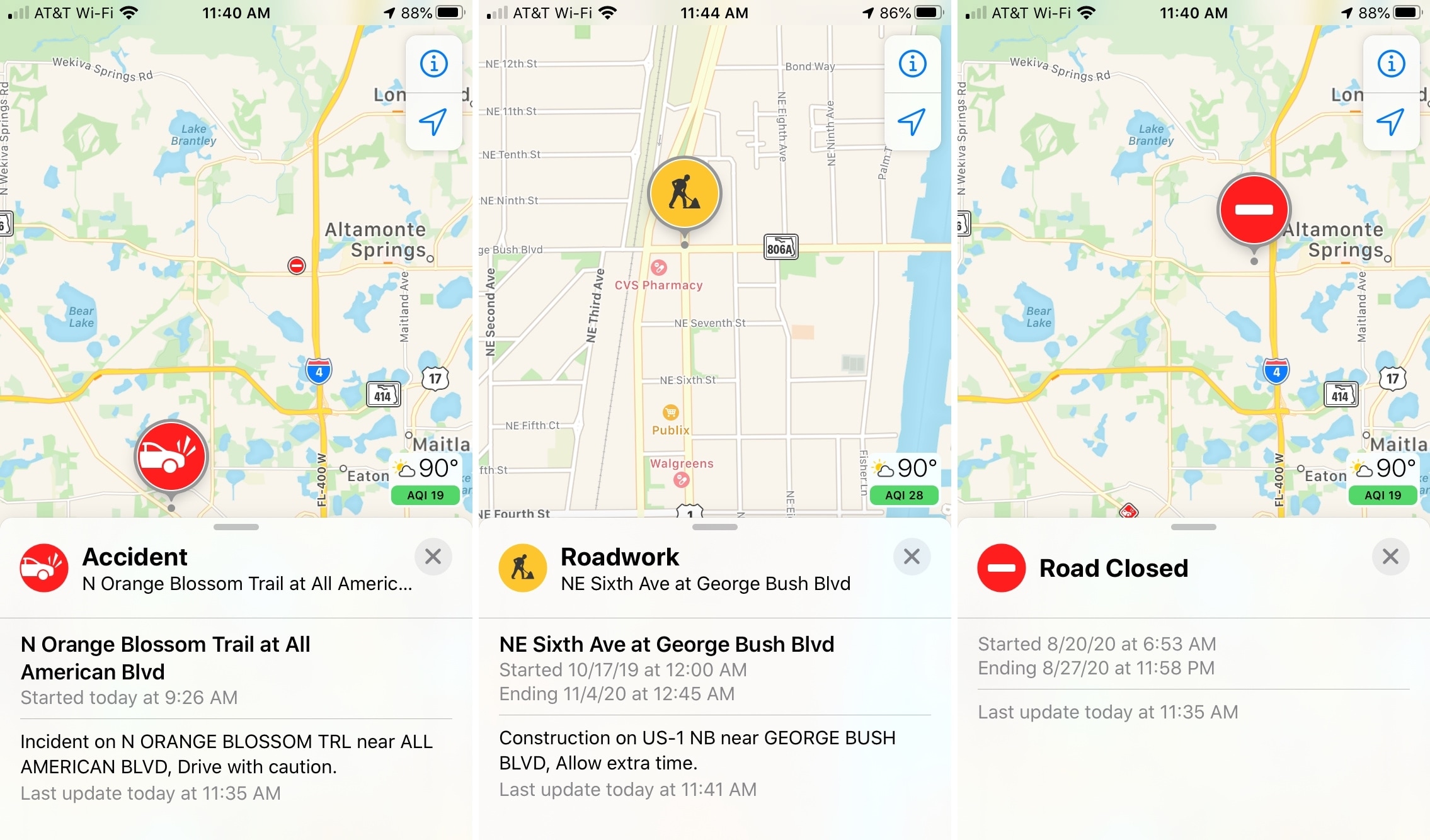
Types of traffic condition markers
Apple Maps uses four icons to indicate road accidents, construction, closed roads, and general alerts.

You can click any traffic condition marker on the map for details. For roadwork and closures, details include the start and end time. For crashes, you’ll see when they started. Details like these can help you better plan your route.
Aside from traffic condition markers, the Maps app also shows slowdowns on roads, highways, and interstates. Like Maps on the iPhone and iPad, your Mac indicates slow-moving traffic with orange. And if you see red, that’s a stop-and-go traffic.
Knowing the current traffic conditions at your fingertips can save you from the frustration and time waste that come with unexpected detours on travels. If you prefer Apple Maps and plan your route before hitting the road, you’ll be thankful for these markers. Apple’s iOS Feature Availability page lists countries in which Apple Maps traffic conditions are available.

Are you liking traffic conditions on Apple Maps? Do you find this feature, or do you think it could be improved? Let us know in the comments below!
More on Apple Maps: