Learn how to view the GPS coordinates of photos and videos on your iPhone or iPad using Apple Photos or free third-party apps to see where they were taken.
Viewing the longitude and latitude points where a photo was taken is simple, as long as you have enabled the location setting for your iPhone camera app. This also works for pictures taken using other devices, such as an Android phone or digital camera, provided the GPS coordinates are added to that photo’s metadata.
See the photo location in the Apple Photos app
Open the Photos app on your iPhone or iPad, then tap a picture, and you’ll see its location at the top.

To see the exact coordinates, swipe up on the screen or tap the info icon ⓘ. Then, tap the place name, which will open the Apple Maps app and display the latitude and longitude of where this picture was taken.

Use free apps to view GPS metadata
If you search the App Store for tools to give you GPS coordinates for photos, you’ll see more than enough options. Here are just a few of those apps that do the job well.
- Exif Metadata
- Exif Viewer
- Koredoko
Each of these apps works just fine and provides metadata for photos you open within the app.
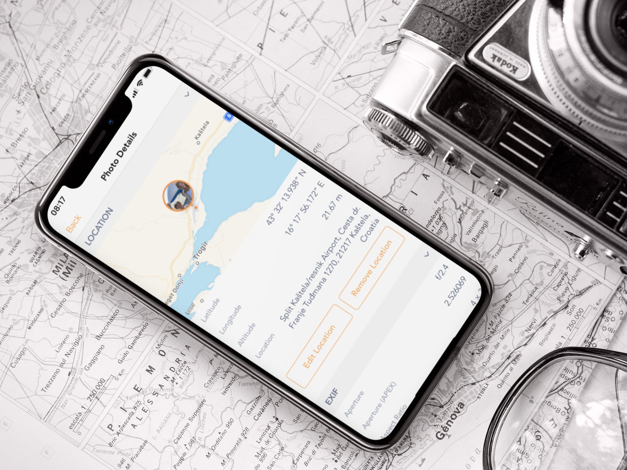
Exif Metadata

Exif Metadata was developed by iDB to offer multiple metadata-related features to your iPhone and iPad photos. When you open Exif Metadata, you can select a photo or narrow down your search to specific albums. You’ll get basic metadata in the photo preview, and you’ll also see all of the data with the GPS coordinates along with a map view.
In the app’s settings, you can change the format of how GPS coordinates are displayed between Decimal Degrees, Degrees, Decimal Minutes, and Degrees, Minutes, and Seconds. The app also displays altitude in feet or meters. And you can even use it to edit or remove the location and other photo metadata.
Exif Viewer
Exif Viewer also makes it easy to see the GPS coordinates. Tap Open at the bottom to locate your photo. When you select the photo you want, you’ll immediately see the metadata, including GPS coordinates, latitude and longitude references, altitude, direction, and more as you scroll through the data.
Koredoko
Koredoko is another app you can use to easily view GPS coordinates. Tap the three-line button at the bottom left to access your albums and select the photo you want. You can see as you scroll through your images that photos with those coordinates display them in the preview. And, if you tap a photo, you’ll see these same coordinates with the photo on a map.
Remember that you can also access Map view in the Photos app to see all the places where your iPhone photos were taken. Plus, when you’re sharing a photo, you can flip a switch to strip away the location data to increase your privacy. And in case you spend most of your time on your Mac, learn about these 5 quick ways to view the EXIF metadata of any photo there.